Satellite Mapping and AI: What Brazilian Forest Protection Teaches French Businesses About Geospatial Data Power
The news is striking at first glance: Google has partnered with the Brazilian government to deploy satellite mapping powered by artificial intelligence, aimed at monitoring and protecting the Amazon rainforests in near real-time. Behind this environmentally-focused project lies a major strategic lesson for French enterprises: AI applied to geospatial data is no longer reserved for space agencies or tech giants. It has become a concrete operational lever, accessible, and rich with measurable business value.
For executives, CSR managers, CIOs, and digital transformation directors reading these lines, the Google-Brazil partnership is a strong signal. It illustrates how the combination of massive satellite data, machine learning models, and visualization interfaces can generate faster, more reliable, and more transparent decisions — across any industry sector.
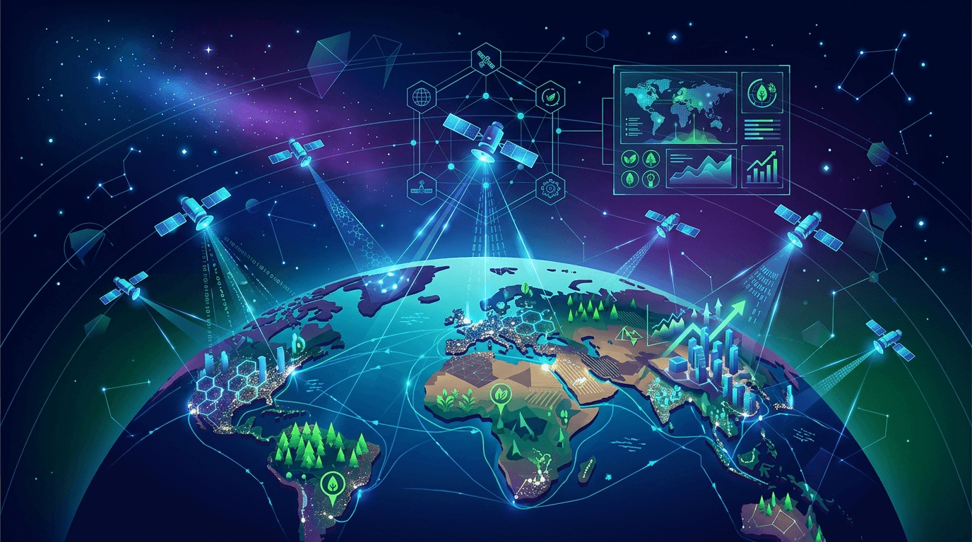
Geospatial AI: A Disruptive Technology That Far Exceeds Ecology
Intelligent satellite mapping relies on a seemingly simple principle: images captured from Earth's orbit are analyzed by algorithms capable of detecting minute changes — disappearance of forest cover, urban zone evolution, modification of logistics infrastructure. What once took teams of human analysts weeks to accomplish now happens in hours, or even continuously.
By developing this tool for Brazil, Google mobilizes technologies it has perfected over years: Google Earth Engine, computer vision models trained on billions of images, and data processing pipelines at planetary scale. The result is a dynamic map that allows Brazilian authorities to identify zones of illegal deforestation before they even expand.
But transpose this logic to a French business context: an agribusiness group monitoring supplier agricultural plots, a retail chain optimizing warehouse placement, an insurer assessing climate risks on a real estate portfolio, or an industrial manufacturer monitoring its production sites internationally. Use cases abound, and technological maturity is here.
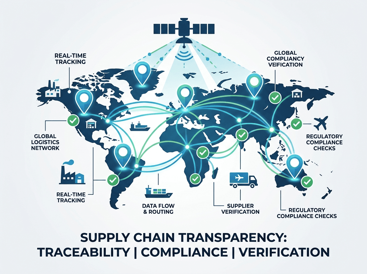
CSR, Compliance, and Supply Chain: Satellite AI as Response to New Regulatory Requirements
France and the European Union now impose strengthened transparency obligations on companies regarding their environmental impacts. The CSRD directive (Corporate Sustainability Reporting Directive), progressively entering force since 2024, constrains thousands of French enterprises to precisely document their ecological footprint, including across their global supply chains.
This is precisely where geospatial AI becomes both a compliance tool and a strategic one. In concrete terms:
- A luxury group sourcing plant-based raw materials can now automatically verify that its suppliers do not operate in deforestation zones, by cross-referencing supplier facility GPS coordinates with updated satellite maps.
- A major retail player can continuously audit its agricultural suppliers in Brazil, Indonesia, or sub-Saharan Africa, without deploying a single field team.
- A construction company can track the evolution of protected zones around its worksites to anticipate local regulatory constraints.
These applications are not science fiction. French startups like Kayrros or Geosys, and international platforms like Planet Labs, already offer commercial services built on these technological foundations. The question is no longer "is this possible?" but "is my company ready to leverage it?"
From Raw Data to Decision: How to Structure a Geospatial AI Project in Your Enterprise
One of the most valuable lessons from the Google-Brazil project lies in its methodological architecture. It's not simply a matter of technology: it's a matter of organization, data governance, and inter-team collaboration.
For a geospatial AI project to generate value in an enterprise, several conditions must be met:
1. Define a precise and measurable use case. AI doesn't solve vague problems. It optimizes identified processes. Before talking about satellites or algorithms, you must know which decision you're seeking to improve, at what frequency, and with what required precision level.
2. Ensure data quality and legality. Commercial satellite data is subject to specific usage licenses. Internal data (supplier GPS coordinates, site perimeters) must be structured and reliable. A poorly fed project will produce unusable, even dangerous, results.
3. Build decision interfaces, not just models. The Brazilian project isn't limited to a detection algorithm: it produces a visual, actionable map, understandable by non-technical decision-makers. This is the link often neglected in enterprise AI projects.
4. Integrate continuous update logic. A satellite map's value lies in its freshness. A model trained once and never updated quickly loses operational relevance.
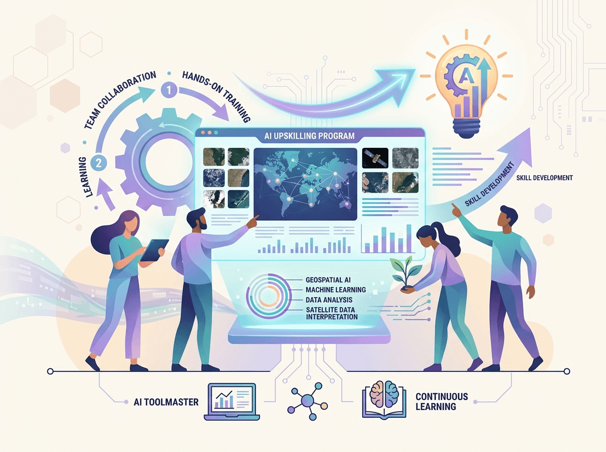
Training Your Teams in Geospatial AI: A Strategic Investment, Not an Option
Adoption of these technologies in enterprises often encounters an obstacle less visible than cost or technical complexity: a deficit of internal skills. CSR teams don't speak the same language as data scientists. Procurement managers don't know how to interpret a satellite image. Executives struggle to assess the reliability of a predictive model.
This is why training constitutes the true pivot of any successful AI transformation. Training your teams doesn't mean turning them into engineers. It means giving them the keys to:
- Understand the capabilities and limitations of available geospatial AI tools on the market
- Formulate relevant specifications for external providers or internal data teams
- Interpret results and make informed decisions based on them
- Identify risks related to data quality, algorithmic bias, and GDPR compliance
At Ikasia, we support French enterprises in this skills development with customized training programs adapted to specific sectoral challenges — from agribusiness to finance, retail, and services. Our training programs combine solid conceptual foundations and practical workshops grounded in your teams' real-world business realities.
Take Action with Ikasia
The partnership between Google and the Brazilian government is not just good news for the Amazon. It's an alarm signal for all French enterprises that haven't yet structured their AI strategy around environmental and geospatial data.
Enterprises that succeed in integrating these technologies into their decision-making processes will gain significant advantage — on regulatory compliance, supplier risk management, CSR credibility, and operational efficiency.
Do you want to evaluate the potential of geospatial AI for your sector, or train your teams in new artificial intelligence applications? Discover our training programs and consulting offerings at ikasia.ai. Our experts are available for an initial diagnostic discussion, at no commitment, to identify the most relevant opportunities for your organization.
Tags
Related articles

Google Finance Exits Beta: What the AI-Powered Financial Analysis Revolution Means for French Businesses
Read
Google Translate Turns 20: What This Reveals About AI Maturity for French Businesses
Read
When AI Solves Quantum Physics Equations: What It Actually Means for Your Business
ReadWant to go further?
Ikasia offers AI training designed for professionals. From strategy to hands-on technical workshops.